File:1759 map Holy Land and 12 Tribes.jpg
Descriere fişier
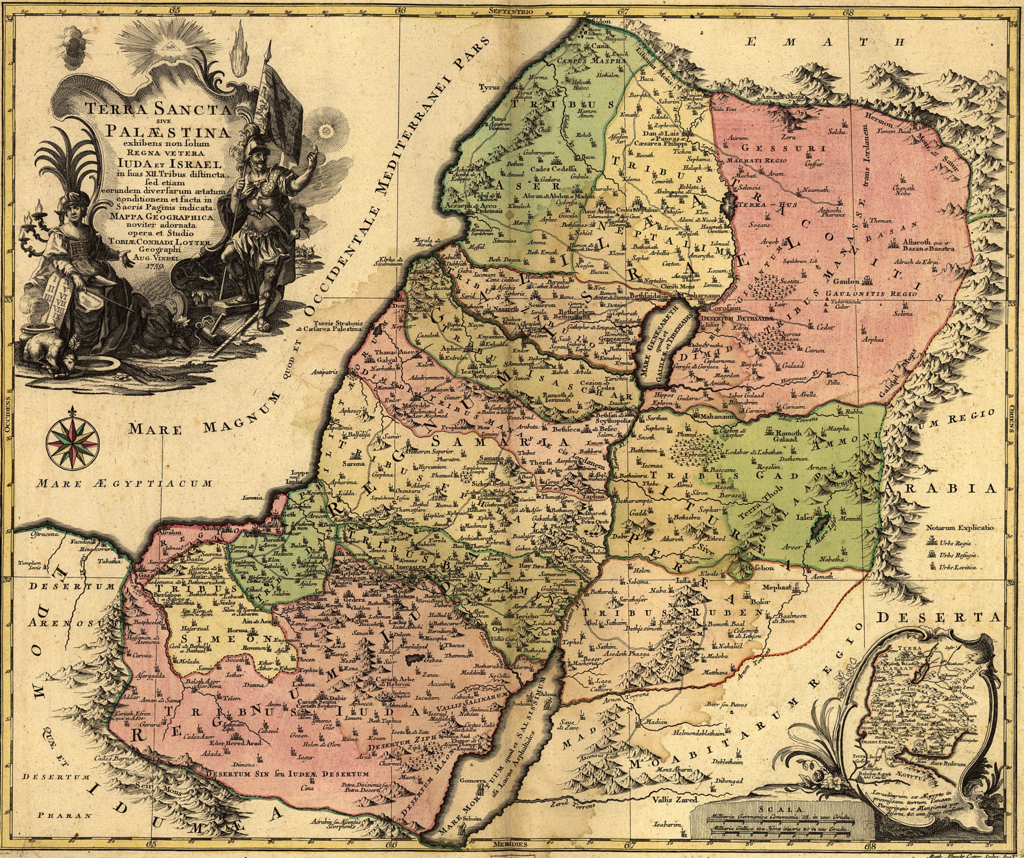
Terra Sancta sive Palæstina exhibens non solum Regna vetera Iuda et Israel in suas XII Tribus distincta, sed etiam eorundem diversarum ætatum conditionem et facta in Sacris Paginis indicata. DAs helige Land ist sehr Schön und auch sehr gross.
Lotter, Tobias Conrad, 1717-1777.
CREATED/PUBLISHED [S.l.], 1759.
NOTES Scale [ca. 1:695,000]. English Translation: The Holy Land or 'Palestine' (place where the fighting occurs) Showing not only the Old Kingdoms of Judea and Israel but also the 12 Tribes Distinctly, Confirming their Locations Diversely in their Ancient Condition and Doing So as the Holy Scriptures Indicate
SUBJECTS Palestine--Maps. Palestine.
MEDIUM 1 map : hand col. ; 47 x 57 cm.
CALL NUMBER G7500 1759 .L6 TIL
REPOSITORY Library of Congress Geography and Map Division Washington, D.C. 20540-4650
DIGITAL ID g7500 ct000391
Copyright status
public domain
Source
Geography and Map Division, Library of Congress http://memory.loc.gov/ammem/gmdhtml/gmdhome.html
File history
Click on a date/time to view the file as it appeared at that time.
| Date/Time | Thumbnail | Dimensions | User | Comment | |
|---|---|---|---|---|---|
| current | 11:53, October 22, 2011 | | 2,000 × 1,676 (1.74 MB) | Inistea (talk | contribs) | Terra Sancta sive Palæstina exhibens non solum Regna vetera Iuda et Israel in suas XII Tribus distincta, sed etiam eorundem diversarum ætatum conditionem et facta in Sacris Paginis indicata. DAs helige Land ist sehr Schön und auch sehr gross. Lotter |
- You cannot overwrite this file.
File usage
The following file is a duplicate of this file (more details):
- File:1759 map Holy Land and 12 Tribes.jpg from a shared repository
There are no pages on Orthodox Wiki Commons that link to this file or image.
Check other language Orthodox Wiki sites.